

Application of Remote Sensing: Transforming Perspectives on Earth
Introduction
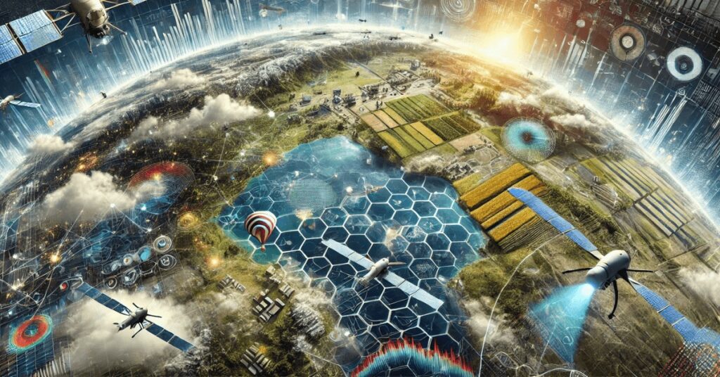
Remote sensing is a transformative technology that has reshaped how we understand and interact with our environment. By enabling the collection of data from a distance—through satellites, drones, and aircraft—it provides insights into natural and human-made phenomena. This non-invasive method of observation has vast applications in fields ranging from agriculture to urban planning, disaster management, and environmental conservation. In this blog post, we’ll explore the depth and breadth of remote sensing applications, diving into its profound impact on science, industry, and everyday life.

Understanding Remote Sensing
Remote sensing involves the acquisition of information about an object or area without being in direct contact with it. This is achieved by detecting electromagnetic radiation reflected or emitted from the Earth’s surface. The process encompasses several steps, including data collection, image processing, and interpretation.
Key components of remote sensing include:
- Sensors: Devices used to capture data, either active (like radar, which emits its own signal) or passive (like optical cameras, relying on sunlight or thermal radiation).
- Platforms: The vehicles carrying sensors, such as satellites, airplanes, or drones.
- Data Processing Systems: Tools and software that process raw data into usable formats, often employing advanced algorithms for analysis.
Applications of Remote Sensing
1. Environmental Monitoring
Remote sensing is indispensable for monitoring environmental changes on a local and global scale. It tracks critical parameters like deforestation, desertification, glacial retreat, and urban sprawl. This data is vital for assessing the impacts of climate change and implementing mitigation strategies.
Key Examples:
- Deforestation Monitoring: Satellite imagery detects changes in forest cover, helping governments and NGOs combat illegal logging and plan reforestation initiatives.
- Glacial Studies: Remote sensing monitors glacier size and movement, crucial for understanding sea-level rise.
2. Disaster Management
In disaster management, remote sensing provides timely data for preparedness, response, and recovery. It supports early warning systems for natural hazards and facilitates damage assessment post-disaster.
Applications in Disaster Management:
- Flood Monitoring: Detecting water levels and flood extents using radar sensors, even during cloudy conditions.
- Earthquake Impact Analysis: Identifying areas of infrastructure collapse and assessing land deformation.
This capability ensures a rapid response to disasters, minimizing casualties and economic losses.
3. Agricultural Advancements
In agriculture, remote sensing revolutionizes farming practices, enabling precision agriculture and efficient resource management.
Key Uses:
- Crop Health Monitoring: Multispectral imaging identifies stress in crops due to pests, diseases, or insufficient nutrients.
- Soil Analysis: Mapping soil properties such as texture, moisture, and salinity ensures optimal crop management.
- Drought Assessment: Monitoring rainfall patterns and soil moisture helps predict and manage drought conditions.
Farmers use these insights to increase yields while reducing input costs and environmental impacts.
4. Urban Planning and Development
Urban planners leverage remote sensing to design sustainable and efficient cities. It provides critical data for land use planning, transportation systems, and infrastructure development.
Applications in Urban Planning:
- Land Use Mapping: Identifying patterns of residential, commercial, and industrial areas.
- Traffic Management: Analyzing traffic congestion and optimizing road networks.
- Smart Cities: Remote sensing integrates with GIS to design smart city solutions for energy efficiency and better public services.
5. Climate Change and Weather Prediction
Remote sensing is a cornerstone of climate science, offering data on atmospheric composition, ocean currents, and temperature variations. It aids in predicting weather patterns, such as monsoons, hurricanes, and El Niño effects.
Major Contributions:
- Greenhouse Gas Monitoring: Tracking CO2, methane, and other emissions.
- Polar Ice Melt Studies: Analyzing ice sheet dynamics to predict global climate trends.
6. Hydrology and Water Resource Management
Remote sensing supports the sustainable management of water resources. It tracks water bodies, assesses water quality, and predicts hydrological disasters.
Notable Applications:
- Reservoir Monitoring: Tracking water levels for irrigation and drinking supply.
- Flood Management: Identifying flood-prone areas to aid in risk reduction strategies.
7. Oceanography and Marine Studies
The study of oceans benefits immensely from remote sensing, which provides insights into sea surface temperatures, coral reef health, and marine pollution.
Core Uses:
- Oil Spill Detection: Rapid identification and tracking of spills to mitigate environmental damage.
- Marine Ecosystem Monitoring: Assessing biodiversity and the impacts of human activities on marine life.
8. Archaeological Exploration
Remote sensing has become a powerful tool for uncovering archaeological sites hidden beneath dense forests or desert sands.
Applications:
- Site Discovery: Detecting structures like pyramids or ancient cities using thermal imaging and LiDAR.
- Preservation Planning: Monitoring site conditions to prevent further degradation.
9. Wildlife Conservation
Conservationists use remote sensing to protect endangered species by studying their habitats and migration patterns.
Examples:
- Habitat Mapping: Identifying regions critical for species survival.
- Tracking Movements: Satellite tagging of animals like elephants and whales to study migration and behavior.
10. National Security and Defense
Remote sensing is integral to defense operations, offering capabilities in border surveillance, reconnaissance, and terrain analysis.
Defense Applications:
- Surveillance: Monitoring activities across national borders.
- Strategic Planning: Analyzing terrain for military operations.
Conclusion
Remote sensing is much more than a technological marvel—it’s a critical tool for solving some of the world’s most pressing challenges. By providing accurate, real-time insights across diverse domains, it empowers scientists, policymakers, and industries to make informed decisions. As technology evolves, the applications of remote sensing will only grow, transforming our ability to understand and protect the world around us.